Provide the "Situational Awareness" and "Suggestions" Necessary to Realize Safe and Secure Living by Satellite Information Services Challenge to the Undeveloped Space Genre
Release:
Update:
NEW
INTRODUCTION
Nowadays, everyone uses map applications as a matter of course. By simply switching layers, you can view aerial photos taken by satellite a short time ago at any time. As we speak, more than 10,000 satellites from various countries and companies orbit the earth, and some are used for land maintenance and disaster monitoring.
Nippon Koei is developing "satellite information services" by utilizing these satellites. Although this genre is expected to grow significantly in the future, we are currently starting from the beginning to develop the market. We are starting a new space business in order to realize national land resilience and people's safe living, and to pursue future possibilities.
PROFILE
-
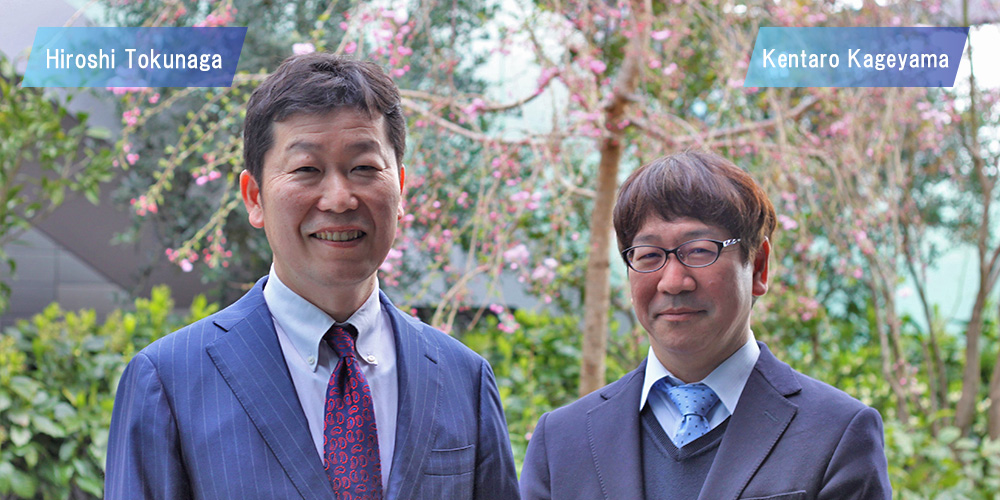
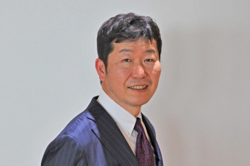
Nippon Koei Co., Ltd., Satellite Information Service Center, Director
Hiroshi Tokunaga
Joined the company in 1992. Worked at Sendai Branch, Erosion Control and Landslide Engineering Center, Osaka Branch, and Tokyo Head Office. He has been engaged in a wide range of projects in the fields of disaster prevention and erosion control, including dams and roads, in addition to municipal services and direct control of erosion control projects.
-
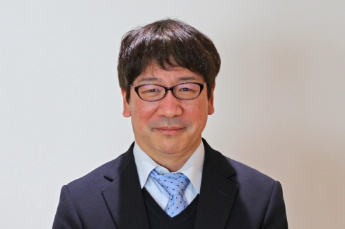
Nippon Koei Co., Ltd., Satellite Information Service Center, Deputy Director
Kentaro Kageyama
Joined the company in 1994. Assigned to the River and Water Engineering Department, then to the Osaka Branch, River Department, where he served as Manager of the River Department from 2018 and Deputy Manager of the River and Water Resources Department from 2020, before transferring to the Satellite Information Service Center in July 2021, where he also served as Acting General Manager of the Satellite Information Service Center and was concurrently transferred to the Satellite Information Service Co. Since joining the company, he has been engaged in various projects as a professional in river rehabilitation projects, including river surveys, river rehabilitation planning, and river structure design.
- *The department name, job title, and interview content were at the time of the interview.
STORY
Satellite imaging technology is constantly advancing.
Hone skills to visualize specialized objects from a bird's eye view.
−−−Professionals in land development, facility maintenance, and disaster management need satellite imaging data to further improve their services. Imaging technology is evolving day by day, and new optical and SAR satellites with certain levels of resolution are available. The state of various imaging targets is being visualized.
Nippon Koei proposes solutions to solve social issues by combining data obtained from satellites with the consulting expertise we have accumulated over the years. We are developing satellite information services from the perspective of solving current issues and advancing toward the future.
We have been developing remote sensing technology to examine objects without touching them since before 2000. Remote sensing technology using satellites has quickly improved since the three-year joint development with JAXA starting in fiscal year 2014. We refined the technology to utilize satellite imaging data to improve the efficiency of levee maintenance and management. Thanks to this, the "Infrastructure Displacement Monitoring using the Daichi-2 Synthetic Aperture Radar Satellite", which was jointly developed by JAXA and Nippon Koei, received the 3rd Infrastructure Maintenance Grand Prize※.
Currently, in addition to levee maintenance, we are deploying our technology in many other areas, such as inundation area monitoring in flooding, collapse area monitoring in landslides, urban development monitoring, vegetation monitoring, slope change monitoring, infrastructure facility monitoring, and monitoring in airport maintenance.
- ※Note1:The Infrastructure Maintenance Awards are sponsored by the Ministry of Land, Infrastructure, Transport and Tourism, Ministry of Internal Affairs and Communications, Ministry of Education, Culture, Sports, Science and Technology, Ministry of Health, Labor and Welfare, Ministry of Agriculture, Forestry and Fisheries, and Ministry of Defense to honor those who have made efforts and developed technologies that have achieved outstanding effects and results related to infrastructure maintenance in Japan.
There is a considerable push from the government to foster the private sector in the development of technology using satellites.
This movement is a general trend in the world and applies not only to the United States but also to all countries that have operations in space. Within Japan, I believe that we are catching the wave of this trend early on.
Professionals from various fields will come together to create a market for next-generation businesses.
−−−The areas of technology utilizing satellites are wide-ranging; there are three main ones. The first is the research and development of the satellite itself, the second is the imaging technology for the satellite, and the third is the analysis of the data after it has taken images. Among these areas, Nippon Koei's strength lies in the utilization of post-imaging data from the viewpoint of the field.
When I tell people that we are working on a satellite project, many existing stakeholders say, "Is it true? I am surprised”. This is probably because everyone has the image of Nippon Koei as a consulting firm with many engineers involved in social infrastructure. Of course, this is true, and we are not a company that specializes in satellites. However, I believe that is where our strength lies.
Even if we can fly a satellite and capture images of various situations, what exists beyond that is the site. For example, when it comes to disaster prevention, the sites of floods, inundation, and landslides, as well as the sites of flood control projects and disaster countermeasures, are the very objects that can be viewed from satellites. We at Nippon Koei are proud of our brand power and consulting capabilities, which are among the best in Japan. In other words, the opinions and knowledge of expert engineers with onsite knowhow are compatible with satellite development companies.
The Satellite Information Service Center is currently managed by a four-member team, including myself, who has been involved in landslide countermeasures for many years, and Mr. Kageyama, the acting director of the center, who is a river specialist. In addition, we have one person concurrently working from Slope Engineering Dept., one from Integrated Information Technology Dept., and one from Road Infrastructure Management Dept., covering a wide range of fields related to social infrastructure. It is certain that our involvement with members from the environment, energy, urban space, and overseas departments will increase in the future, and being able to work with people with various specialties both inside and outside the company is not only an incomparably rewarding experience, but also an opportunity for business development.
I am a person who likes to work on new things. This is especially true when it is not something given to me by others, but something that I think up and create on my own. I think most people has the impression that Nippon Koei is a company with many specialized engineers. That is exactly right, and we have been, and still are, sincerely trying to respond to the requests of our customers for the tasks they have given us. However, our mission in the satellite information service business we are developing is to create the market itself. This is a direction we have never taken before, but we want to create something that everyone wants and that everyone will want to imitate. How do we create something that does not exist? That is what I find most rewarding.
We want to continue to be involved with people who are willing to challenge the untapped genre for which there is not even a market.
−−−The evolution of remote sensing technology using satellites may have the potential not only to maintain and manage national land, but also to solve social issues on a global level. What does the future hold for Nippon Koei's satellite information services?
When you talk about a project using satellites, you may get the impression that it is something great. In fact, satellites are just tools. How can we add value by analyzing the images we take from the sky? After the first step of providing useful information to people, I believe that a world in which satellites are used in a very ordinary way will be born. First, we are still in the process of creating the satellite with a same ambition partner company.
As Mr. Kageyama mentioned, satellite image data is only one type of data that captures an object from the sky. But if you look around the world, there is a lot of very compatible data with different cut-off points. For example, probe data captured by vehicle sensors and drive recorders at the ground level, and SNS data. When these are combined with satellite data, the information becomes three-dimensional rather than flat, making it easier to use and more accurate. This type of collaboration is likely to increase in the future.
Today, the term DX (Digital Transformation) is often heard, and the "X" in DX stands not for mere digitization, but for change itself. We hope that Nippon Koei's satellite information services will be the catalyst that triggers this change in society. It is certain that mankind will go further into space in the future. The starting point for expanding into space, such as infrastructure development on the moon and Mars, and maintenance development, is right now. Looking back, we are proceeding with business development and research and development so that the satellite information service business in the 2020s will be a major turning point.
I mentioned that we are taking on the challenge of creating a market, but to do so, we still need more people inside and outside the company. Whether it is a new graduate or someone who joins our company as a career changer, someone within the company who wants to be involved in satellites and space, or of course a company we partner with, we want to build on our desire to take on challenges together and move into the future. This is a proactive approach to human resources that is not easily found at Nippon Koei, but since this is a center that takes on the challenge of an as-yet-undiscovered future, we want to keep moving forward without being bound by precedent.
Space holds infinite possibilities. Now that mankind can launch various satellites and obtain data from them, countries and companies are making strenuous efforts to develop new technologies. Nippon Koei is one of them. As Mr. Kageyama, the center's deputy director, said, "When you challenge the unknown, your heart dances". Always keeping the spirit of challenge in mind, Nippon Koei aims to be a leading-edge company in the space age.