Extraction and Monitoring of High-risk Landslides by Satellite Remote Sensing
Release:
Update:
NEW
CHALLENGE
Increasing Frequency of Landslides
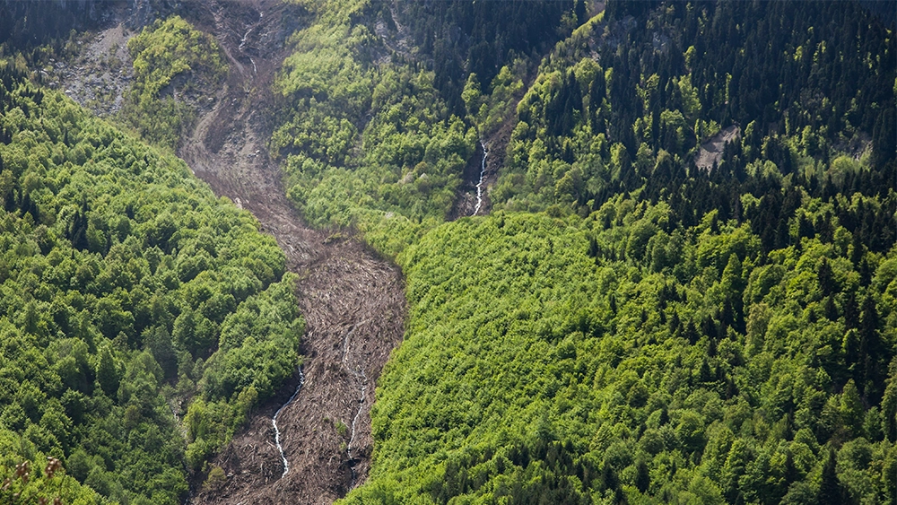
In recent years, landslide disasters with severe damages have been occurring every year in various parts of Japan. Landslide disasters are characterized by continuous sliding and prolonged damage. During heavy rainfall, the sliding speed increases, and the sliding on a large scale may cause extensive damages to house, roads, and railways. On the other hand, landslides may slide slowly even during normal times, and by monitoring their movements, it is possible to identify landslide areas that are moving. Currently, 15,180 landslide warning areas have been designated in Japan*. According to the annual count conducted by the Sabo(Erosion and Sediment Control)Department of the Ministry of Land, Infrastructure, Transport and Tourism, approximately 100 landslide disasters occur annually, some of which are outside of landslide disaster warning areas. As such, it is a challenge to identify and respond to areas that were not recognized as landslide areas. It is important to identify in advance landslide areas with high risk of landslide occurrence and movement, in addition to landslide warning areas, in order to take advance measures before a major damage happens.
- *Landslide disaster prevention zone: An area where the lives or bodies of residents are likely to be harmed in the event of a landslide. The areas are established based on the Landslide Disaster Prevention Act. The number of locations is based on data from the Ministry of Land, Infrastructure, Transport and Tourism's "Designation of Landslide Hazard Watch Areas throughout Japan (as of March 31, 2011).
SOLUTION
Getting Information on the Risk of Landslide Occurrence by Satellite Interferometric SAR Analysis
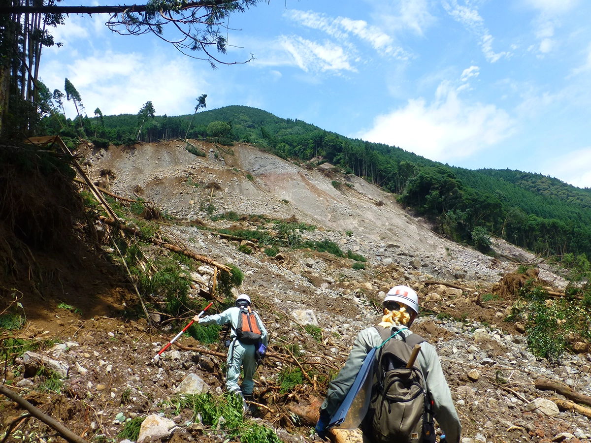
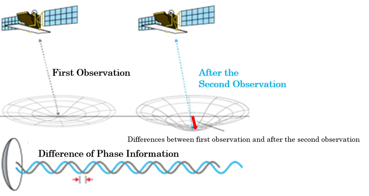
By analyzing radar waves irradiated toward the ground surface from a satellite equipped with a sensor called Synthetic Aperture Radar (SAR), it is possible to identify minute variations in the ground surface. This technique is called interferometric SAR analysis, and it enables us to extract minute changes in the slope, which is a precursor phenomenon before a landslide happens on a large scale. Normally, landslides are identified by field surveys, geological investigations, and monitoring using field observation instruments. However, there are a large number of slopes with potential for landslides in various parts of Japan, such as those designated as landslide hazard areas, and it is not easy to conduct detailed field surveys of all of them in terms of human and economic resources. We are conducting interferometric SAR analysis as a screening method prior to conducting detailed field surveys to obtain information about landslide sliding conditions in the targeted areas. By assessing the priority of landslide countermeasures based on the screening results of the interferometric SAR analysis and various conditions such as the importance of the conservation target and regional characteristics, we can quickly respond to areas that require countermeasures. We also provide community-based services with more than 200 engineers specializing in slope disaster prevention at our branches and offices nationwide. In addition to providing the results of interferometric SAR analysis, we can also provide one-stop services for subsequent detailed surveys and countermeasure design.
RESULT
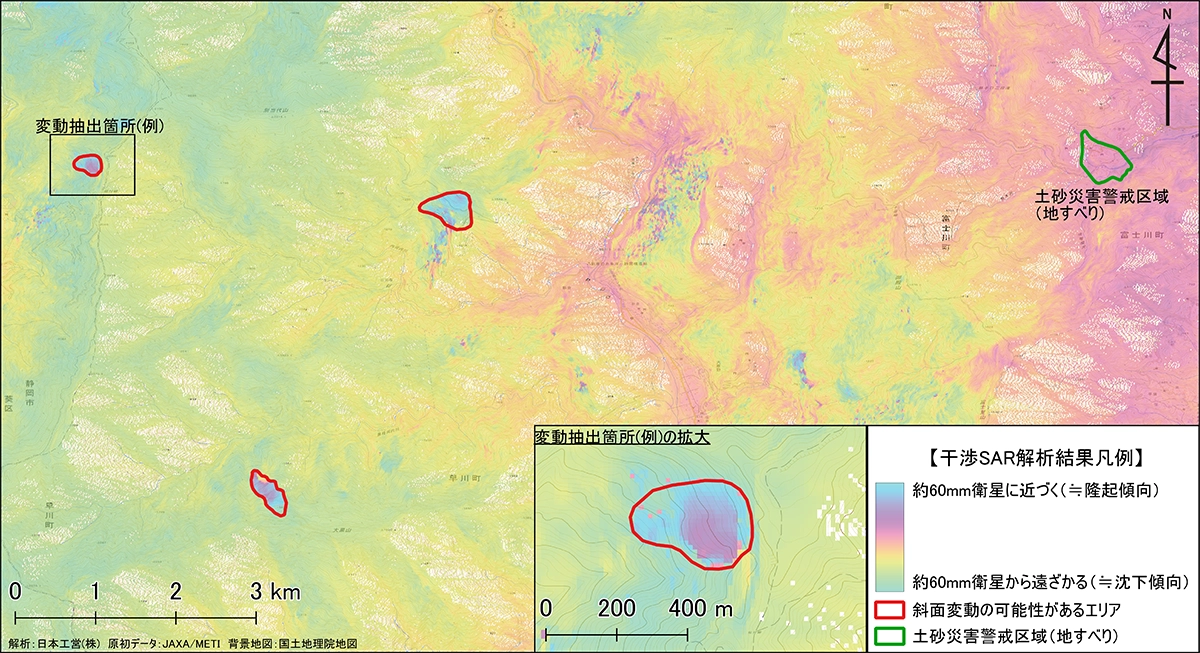
Wide-area Screening of Landslides by Interferometric SAR Analysis
We conducted a wide-area screening around Hayakawa Town, Yamanashi Prefecture, by performing interferometric SAR analysis using the satellite data acquired by PALSAR 2 onboard the Daichi-2 Satellite. Based on the interpretation of the results of the interferometric SAR analysis and the topographical interpretation by our slope disaster prevention engineers, we identified three locations where landslide deformation may have occurred (in the red frame in the figure). These areas were not designated as landslide hazard areas and had a high possibility of having unknown landslides. On the other hand, no significant changes were observed in the existing landslide hazard areas (upper right in the figure) at the time of analysis. We are currently working on the improvement of the interferometric SAR analysis algorithm specialized for slope deformation in order to understand the landslide movement in more detail.
- *The method of deciphering the results of the interferometric SAR analysis is explained in detail on the Geospatial Information Authority of Japan website.
https://www.gsi.go.jp/uchusokuchi/gsi_sar_faq3.html#3-2